If you’re curious, you can use Google Maps to see older images of any location on Earth—as long as it has an older picture. That’s because Google regularly updates the photography it uses for Street View navigation. If you want to check out older images in Google Maps, follow the steps below.
How to See Older Images in Google Maps on a PC or Mac
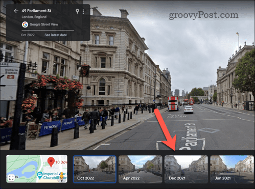
Street View allows you to travel through Google Maps as if you were walking or driving through different streets, giving you a more typical view of the history of your favorite areas. If you’re using Google Maps on a PC or Mac, you can quickly view older Street View images using a web browser on your PC, Mac, or Chromebook. To see older images in Google Maps on a PC or Mac:
How to See Older Images on Google Maps on Android or iPhone
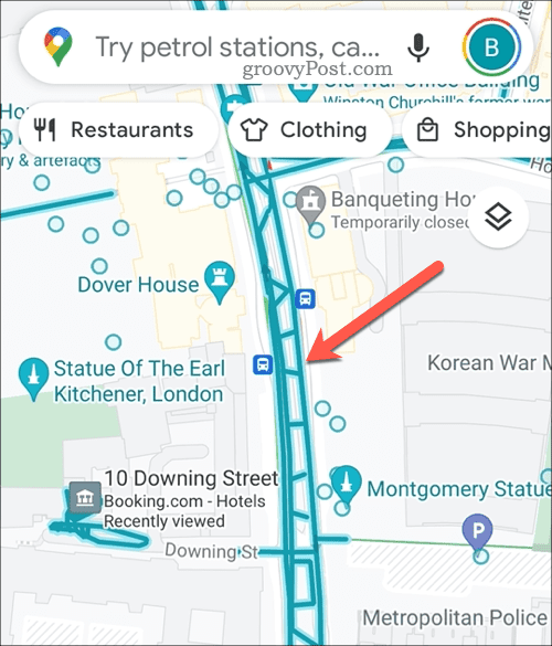
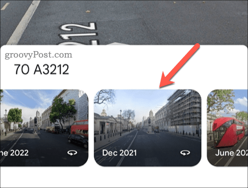
Using an Android or iPhone device, you can check out older Street View images using the Google Maps app. To see older images in Google Maps on mobile:
Exploring Old Neighbourhoods in Google Maps
Google Maps is more than just a tool for finding directions and exploring new places. Thanks to older Street View imagery, it also gives you a way of traveling back in time and seeing how things have changed over time. Are you new to Google Maps? You could try to use Google Maps as a travel diary, keeping track of the trips you’ve been making. Like the outdoors? You can use Google Maps to plan hikes rather than relying on cars or public transport. That said, Google Maps is the perfect tool to plan your next road trip. Don’t forget to calibrate Google Maps before you set off to ensure your location and built-in mobile compass are working correctly. Comment Name * Email *
Δ Save my name and email and send me emails as new comments are made to this post.
![]()


